


News

City of Bartlesville
Posted: Apr 28, 2022 9:33 AMUpdated: Apr 28, 2022 9:41 AM
Pathfinder Maps, Details Available on "AllTrails" App

In an effort to reduce the amount of litter left behind at Pathfinder Parkway, the City of Bartlesville’s Parks and Recreation Department is encouraging patrons to go mobile.
Pedestrians and cyclists alike can download the AllTrails app, an interactive app designed to view trail maps and information. The app is available for both Apple and Android users and provides a range of user-friendly features, such as navigation and tracking, time tracking, elevation changes, total distance, average pace, average speed, and calories burned.
In addition, the use of mobile trail maps helps to reduce littler left behind on trails.
In a statement, Community Development Director Lisa Beeman said:
“In the past, we had trail maps printed for Pathfinder Parkway. They are nice, but when we leave them out at the trailheads, people just throw them around and they become litter. So rather than print new trail maps, I would like to encourage people to use the AllTrails app on their smartphone.”
AllTrails can be downloaded from the Apple App Store and the Google Play Store. For more information, visit alltrails.com.
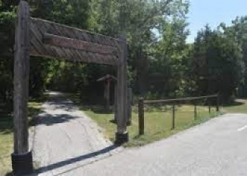
Pathfinder Parkway is a 12-mile trail system that runs throughout the City of Bartlesville. It is open year-round from 6:00 a.m. to 11:00 p.m. Damage or path obstructions should be reported to Parks Superintendent Bobby Robinson at 918.338.4154.
« Back to News