


News

Weather
Posted: Apr 01, 2026 1:43 PMUpdated: Apr 01, 2026 1:47 PM
Rounds of Severe Weather Possible Tonight, Friday Night

Scattered storms are expected to develop close to the Kansas-Oklahoma border near a retreating warm front Wednesday.
Forecast models show these storms will be capable of producing large hail, locally damaging wind and tornadoes.
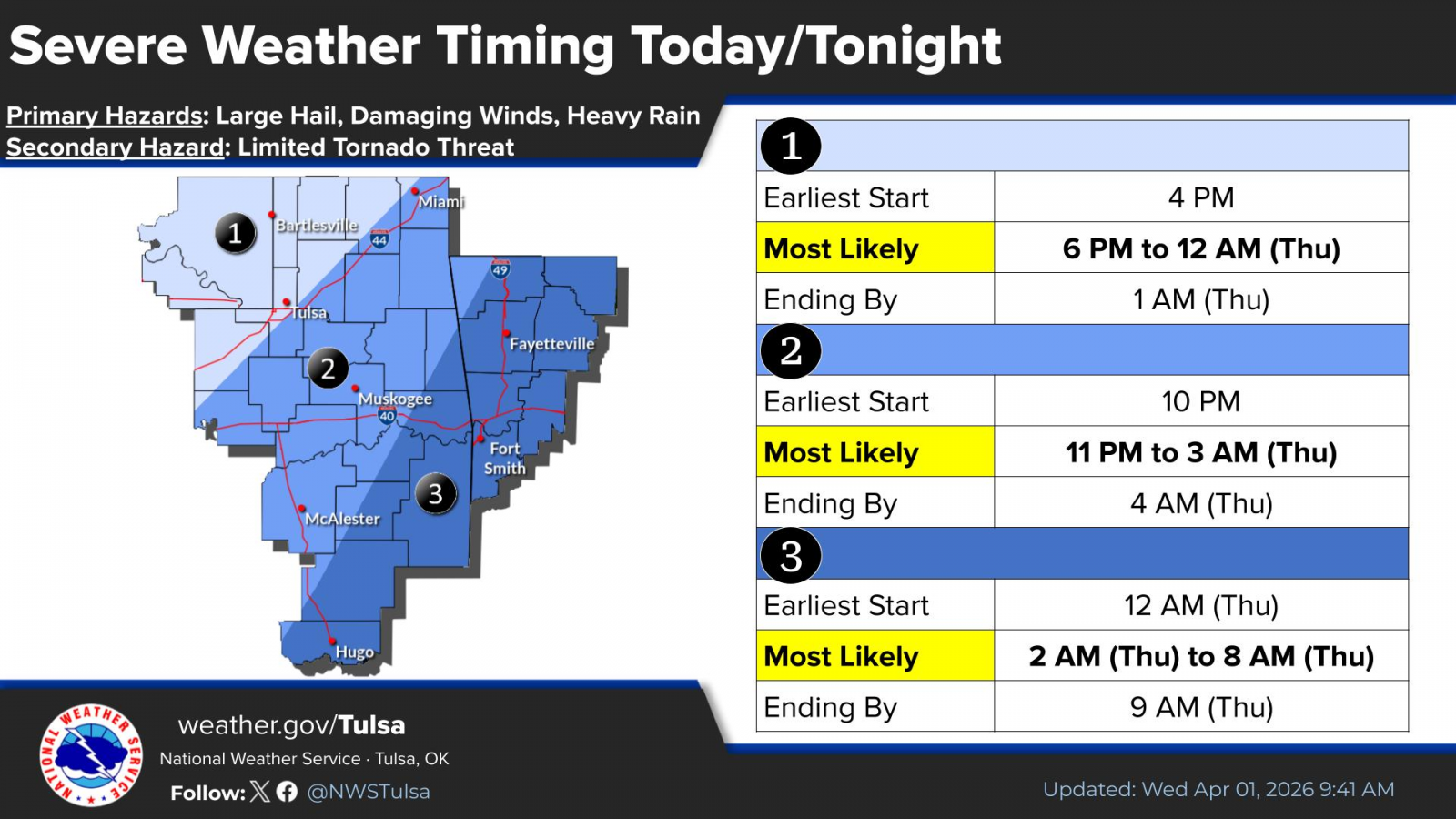
Then, a line of strong to severe thunderstorms are expected to move into eastern Oklahoma Wednesday evening. Damaging wind gusts will be the primary hazard, along with a low potential for quick spin-up tornadoes and possibly some large hail.
.png)
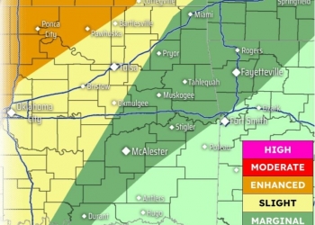
The most likely timing for severe weather is 5 p.m. Wednesday to 1 a.m. Thursday.
A Level 3 out of 5 risk exists for the northern half of Osage County, northern quarter of Washington County. All of Chautauqua County and most of Montgomery County are included in the risk area. A Level 2 risk exists from Bartlesville to the south and east.
Another round of strong to severe storms is expected Friday night into Saturday morning as a cold front move through the area. Scattered to numerous thunderstorms are expected to develop along and just ahead of the approaching front.
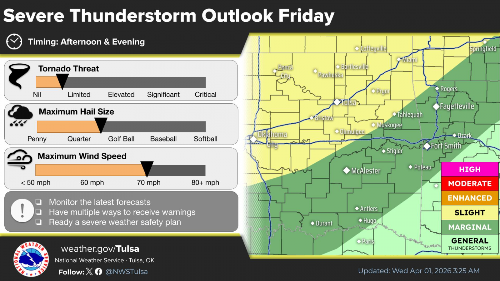
Instability, moisture and shear will be in place for isolated to scattered strong to severe thunderstorms, especially north of I-44 Friday evening into the overnight hours.
« Back to News