


News

Weather
Posted: Apr 14, 2026 10:22 AMUpdated: Apr 14, 2026 10:22 AM
Severe Weather Risk Increases Tuesday, Wednesday Evenings


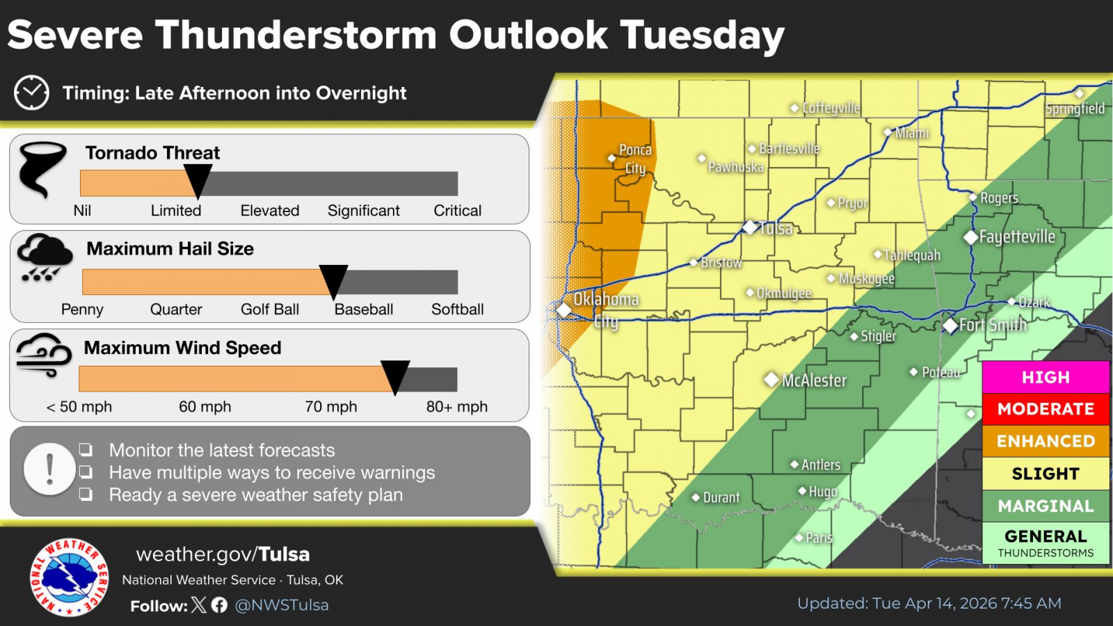
The risk for severe storms Tuesday late afternoon and early evening continues to increase, especially over western Osage County.
A Level 3 of 5 severe weather risk includes areas west of Pawhuska and Fairfax, with a Level 2 of 5 risk for the rest of the listening area. Large hail to the size of a tennis ball, damaging winds to 75 mph and a Level 1 of 4 risk for tornadoes are the main threats.
Late afternoon and evening time frames are most favored for severe weather on Tuesday. Current data indicate the severe weather threat will end west of a line from Vinita to Henryetta by midnight Tuesday night. The time frame for severe weather in the listening area is as early as 4 p.m., where the most likely time frame is between 6 p.m. at 10 p.m.
.png)
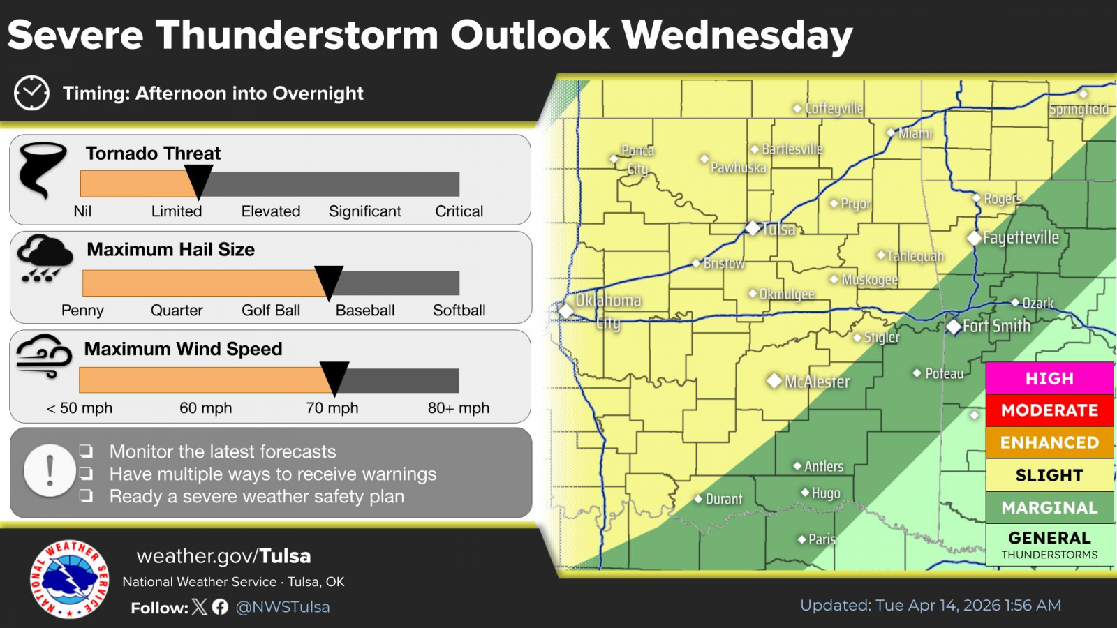
Severe weather threats continue for Wednesday into Wednesday night with a Level 2 of 5 risk level across the area. Large hail to the size of a tennis ball, damaging winds to 70 mph and a limited threat for tornadoes are the main threats for Wednesday.
Stay with your Bartlesville Radio stations for the latest information. We’re here to prepare you, not scare you.
SEVERE RISKS TUESDAY
« Back to News